Exploration - Don David Gold Mine
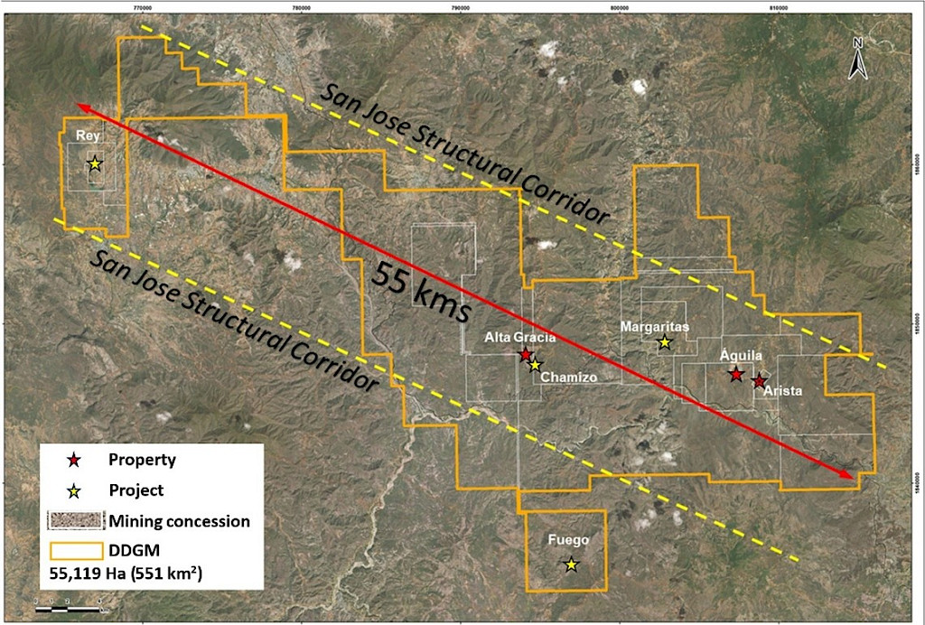
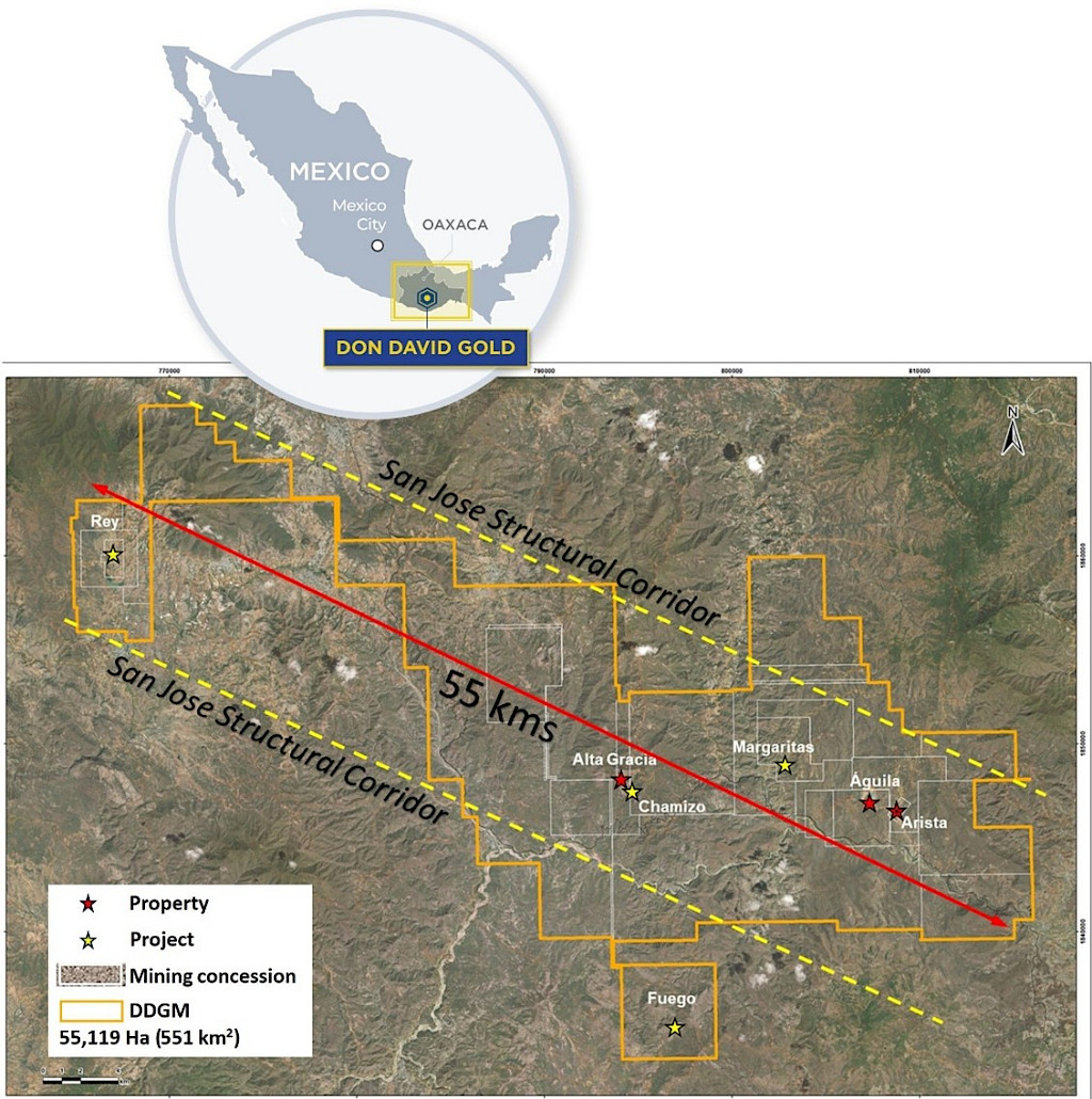
Gold Resource Corporation controls a 100% interest in a large, highly prospective land position in Oaxaca, Mexico. The Company’s six properties cover over 55,000 hectares (551 km²) and span approximately 55 kilometers along the northwest trending San José structural corridor.
Mineralization along this corridor is related to epithermal mineral systems associated with volcanic activity. Gold and silver occur in structurally controlled veins and stockwork zones, commonly with lead, zinc, and copper. Current exploration and development at the Don David Gold Mine (DDGM) are focused on the Arista underground mine area, which includes the Arista, Switchback, and the recently discovered Three Sisters vein systems.
In 2007, surface drilling discovered the Arista vein system at DDGM, confirming a high-grade, polymetallic epithermal system containing gold and silver with associated copper, lead, and zinc. The Arista deposit entered production in March 2011, and underground drilling began that same year to support resource definition and mine development. Step-out drilling from underground stations discovered the Switchback vein system in 2013, expanding the known mineralized footprint northeast of Arista. By 2017, additional underground step-outs identified the first intersections that developed into the Three Sisters vein system, which has since advanced through continued drilling and geologic reinterpretation and entered into production in 2025.
In parallel, exploration continues to advance the Alta Gracia project, which hosts predominantly silver-rich epithermal veins, including the Mirador and Independencia systems. These northeast-trending vein systems have historically supported underground mining and ore feed to the DDGM processing facilities, complementing production from the Arista mine area. Together, Alta Gracia and Arista illustrate the district’s capacity to generate multiple mineable vein systems within the broader San José structural corridor.
DDGM’s district-scale work has also advanced earlier-stage targets beyond the active mine areas. At the El Rey property (approximately 55 km northwest of Arista), drilling has returned high-grade gold results, including 132.5 g/t Au over 1.0 m. The Company also reported initial drill results at the centrally located Las Margaritas project area in 2013, including 2.85 m of 27.90 g/t Au and 2,600 g/t Ag. Regional surface sampling, geologic mapping, and airborne geophysics have generated multiple additional targets between El Aguila and El Rey that warrant follow-up exploration.